Reconstructing Airport Positions from Flight Times

If you had flight times between airports but no map, what shape could you recover?
I built Time / Space to explore that question. It starts with airports scattered randomly in three dimensions, then moves them to make the distances between connected airports match their flight times. No latitude, longitude, or assumed sphere is supplied to the optimizer.
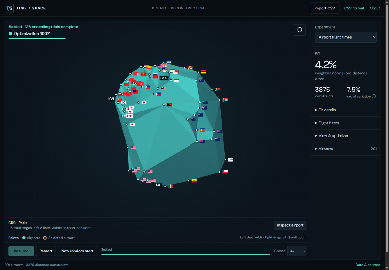
The airport network after fitting. Click the screenshot to explore it.
A flight time becomes a target length: a pair with a longer flight should sit farther apart than a pair with a shorter one. Each connection constrains two points. Taken together, the connections constrain a whole network.
The optimizer repeatedly adjusts the positions to reduce the mismatch between those target lengths and the current straight-line distances. After the local fit settles, it tries perturbations and another random start to search for a better arrangement. You can watch that process, pause it, and rotate the result. The surface drawn between the airports follows their positions; it does not push them into a particular shape.
The airport network settles into a roughly globe-like shape, with recognizable regional groupings and some dents. Its orientation is arbitrary: the flight times alone do not tell it which way is north. A reflected arrangement can fit the same distances, too.
To separate the reconstruction method from the messiness of flight data, the lab also includes two synthetic experiments. One uses exact distances between points on a sphere; the other uses points on a flat plane. Both use the same optimizer, with the original coordinates withheld. The sphere dataset recovers a sphere, and the plane dataset recovers a plane. The shape comes from the distances supplied to it.
Real flight data is less tidy. The built-in observations are published nonstop schedules, rather than measured times from actual flights. Winds, routing, aircraft speeds, and airport overhead all affect the relationship between time and distance. There is also a geometric mismatch: flights travel over the Earth's surface, while the optimizer fits straight-line distances in 3D.
The default filters keep jets, average the two travel directions when both are available, require at least four connections per airport, exclude some inconsistent constraints, and reduce the weight of short flights. These choices make the proxy more useful, but they do not turn schedules into exact distances. A low fitting error does not establish that every airport is in the right place, or that the arrangement is unique.
Try switching between Airport flight times, Synthetic · sphere, and Synthetic · flat plane. Use New random start to compare results, then select an airport and open Inspect airport to see its individual constraints and schedule sources. You can also import your own flight observations as a CSV; the file is processed in your browser.
Open Time / Space and see how much shape emerges from the connections alone.